Archive for September, 2010

AMT Announces Rebuilding of Intermodal Station on the South-Shore, Leaves Open Which Modes These Are

Monday, September 27th, 2010

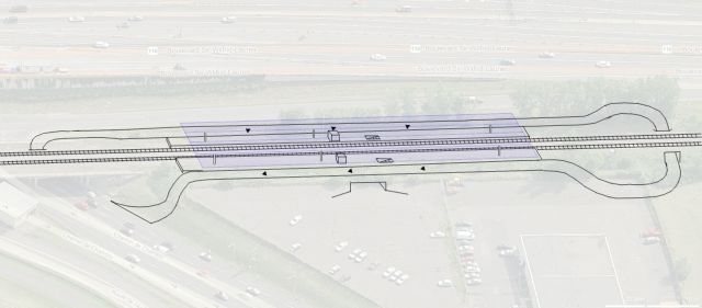
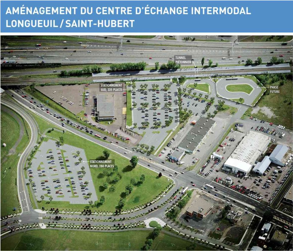
More AMT news, Montreal commuter trains are on a roll. On Friday the agency announced that 19.7 $ Million, compared to the originally budgeted 6.8$ Million, will be spent to rebuild Gare Saint-Hubert into a more permanent commuter rail station. 75% will be paid by the Ministry of Transport of Quebec, the rest by the AMT. The station with rebuilt platforms will include 335 parking spots (on top of the existing 280), a tunnel to connect both platforms, a new ticket vending machine and shelters for rail users. Bids will start in winter 2011, and the construction is scheduled for summer 2011.

Nowadays when I hear inter-modal station, I think trains and cars. It is good that drivers are encouraged to leave their car in the ‘burb, rather than congest them into downtown. But it seems to me that this focus on park-and-ride facilities ignores the fact that the RTL, which serves the greater Longueuil area, provides some of the best bus service a suburb in North America can provide.

It is ironic that the cost increase seems mostly for the benefit of car users. The parking lots apparently add a lot of cost. Yet, it takes up valuable real estate around a train station that is only going to see service increases in the coming years – an ideal place for transit-oriented development. I’ve written about the hidden problems with parking before, but it should be fairly obvious that here, it will force developments away, not promote a transit-dependent life style, and encourage sprawl. At the same time, there are some that claim that the ability for park-and-ride to attract transit users is a myth.

Every parking space represents only one extra rider (maybe 1.3) on the trains. Yet despite not being an ‘intermodal hub’, the station is already served by three bus lines (8,28,88), which together have about 150 departures on a week day in each direction. If ones assumes 10 riders per bus (a very low estimate), it means that about 1500 people can reach the station already – more than twice the capacity of the planned parking lots. And this number could easily be increased when the buses are scheduled around the train station to be a hub – at a fraction of the space(=cost) used by cars.

The strange thing is that according to Longueuil mayor Caroline St-Hilaire, transit oriented development is exactly what they had in mind:

This new economic development center will have a higher density and mixed use, as well as more friendly facilities for mass transit and non-motorized methods of transportation

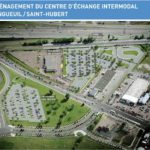
From the planned picture above, and given how much parking space will be added, it is hard to see how these goals will be met.

Now, we can argue back and forth about the problems and merits of park-and-ride facilities vs transit-oriented development, but it should be clear that the intermodal station should be designed first and foremost with the connection between the bus and the train in mind. One way would be to create intermodal platforms, like this
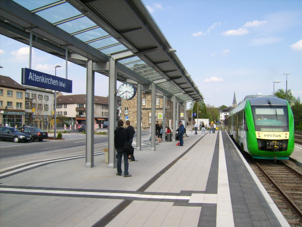
Intermodal Station Altenkirchen (Pop. 6700), Germany. The rail line is single tracked, so all trains stop there.

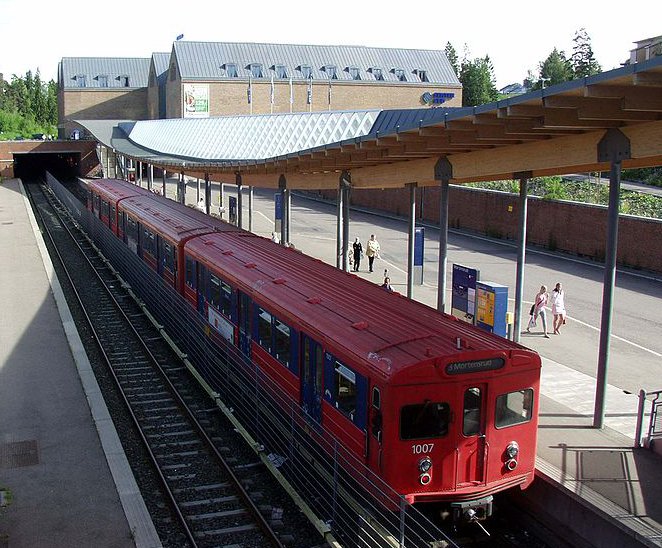
Or like this

Metro Station Mortensrud, Oslo

Conceivable would be a station with two intermodal platforms – in the morning all buses could stop at the platform with the trains going downtown. In the afternoon they could stop at the outgoing platform. Whoever is going against the flow has to go through the tunnel.

If the station is reasonably sheltered, transit riders could switch from bus to train without much effort, and without rain or snow. Now that could provide a ride comfortable enough to persuade drivers to leave their car at home, while rewarding those who do that already.

images sources: AMT handout via Montreal Gazette (thanks to Andy Riga), Altenkirchen, Oslo, own work
Bombardier Unveils Dual Mode Locomotive to be Used by AMT and NJT

Thursday, September 23rd, 2010

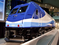
Bombardier yesterday unveiled (also here) its new dual mode locomotive at Innotrans 2010 in Berlin. It is to be used on the new Train de l’Est commuter line in Montreal, and some lines of the New Jersey Transit (NJT).

They trains are purchased in a joint bid by AMT and NJT. The AMT has ordered 20 of these 130-ton machines for 236.3 $M, of which 75% is paid by the ministry of Transports of Quebec, and 25% by the AMT.

This is interesting because this new train could significantly improve the AMT network. The Mount Royal Tunnel going under the mountain does not have enough ventilation to support trains running on diesel engines; only locomotives powered by electricity are allowed through. This means that the only trains that can currently go through the tunnel are the ones of the fully electrified Deux Montagnes Line. But none of the other AMT lines are electrified at all, so the electric trains cannot serve those.

The Dual Mode train, which can switch between electric and Diesel operation, can go through the Mount Royal Tunnel, but at the same operate on any other line. This opens the possibility to finally route the Blainville-St-Jérôme Line directly downtown, and makes the operation of the Train de l’Est, which is now planned to open in 2012, only possible. Additionally this would allow routing lines through downtown, for example all the way from Mont-Saint-Hilaire to St-Jérôme.

But also this opens up the possibility for gradual electrification of the whole commuter rail system. Electrification means cheaper operation of trains. It means the possibility to have rolling stock that accelerates and decelerates faster (because of less weight); giving the possibility for higher frequency and more downtown stations (surface metro, anyone?). The AMT is studying the possibility to electrify the whole system. Let’s just hope that Jöel Gauthier, CEO of AMT, got a chance to ride the S-Bahn in Berlin, to see where the AMT could be in 20 to 30 years.

Every Day Should Be Car-Free Day

Thursday, September 23rd, 2010

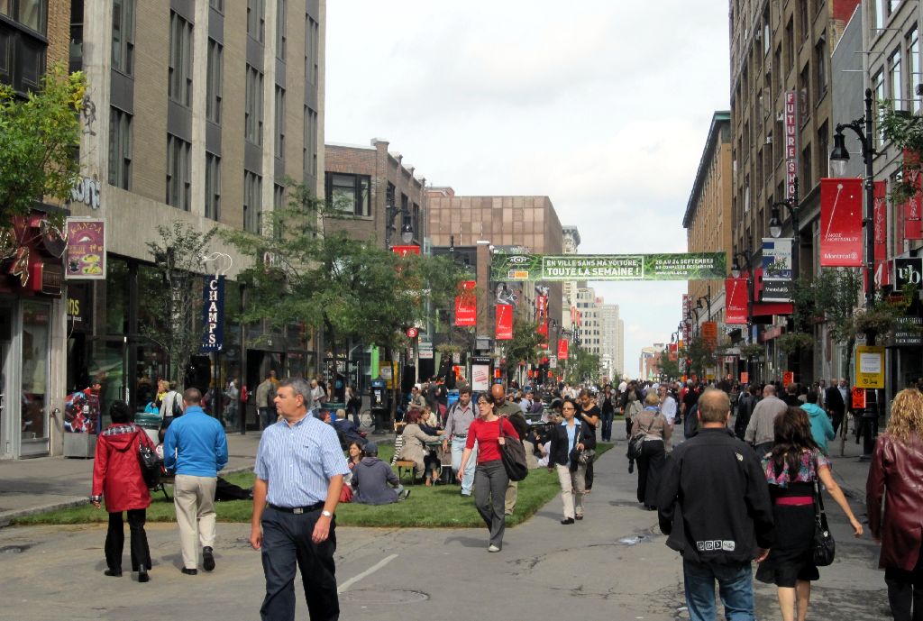
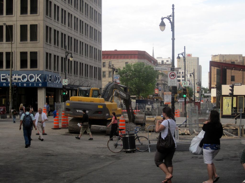
Rue Ste-Catherine in Montreal has been full of people at every occasion they are allowed on the street, including the current car-free week. Since it is a really bad street for cars, would it be a good idea to turn it into a pedestrian mall all the way?

As part of “In Town Without My Car All Week Long!”, held from September 20 to 24, a portion of Montreal’s downtown around Rue Ste-Catherine was open for pedestrian traffic yesterday. Ironic that the official map calls the areas “closed”; I’d probably call them “open”:

Despite being part of a “week” without cars with activities surrounding car free living, the cars were apparently only banned for one day. Which is unfortunate; people seemed to like it. The street really came alive, and the make shift park added a lot of atmosphere; it was kind of Zen.

There has been some talk about pedestrian malls in the blogosphere lately. On the one hand, New York has been expanding it’s pedestrian zones, starting with Times Square last year, and adding newest stretch just yesterday. On the other there are voices saying that pedestrian malls might be hurtful, that some cities actually revived their downtown by bringing back cars, and that pedestrian malls don’t work in North America (compared to Europe or even Australia).

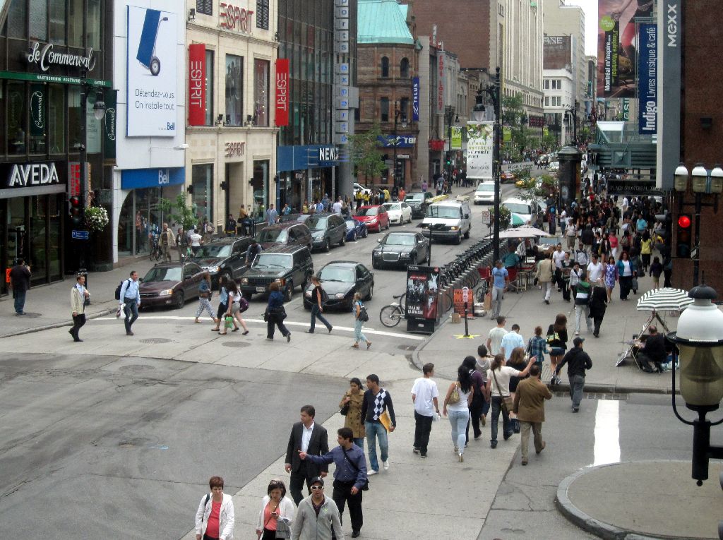
Ste-Catherine during a normal work day - 1 car per 20 pedestrians

The main problem seems to be that a typical downtown of a North American City is a mono-functional office-space-oriented place, which is only alive from 9am to 5pm. After that, everybody goes home. And if you cannot take your car back to downtown, people apparently rather stay back in the suburb. If nobody lives downtown, there shouldn’t be a reason for anybody to be downtown, right? And without people and without cars in the streets, people will start feeling unsafe and continue to avoid the area.

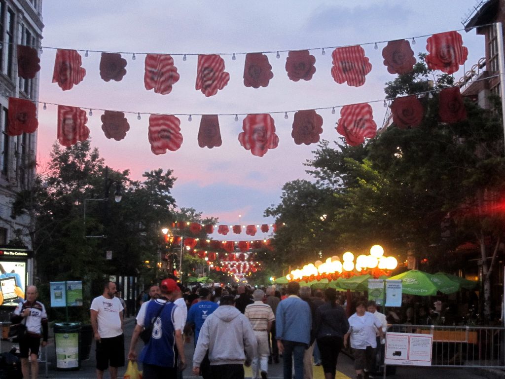
The Gay Village was closed to traffic from May 26 to September 13

But on Ste-Catherine, complete pedestrianization might actually work. Not many people live along the street. Not only does it run through the downtown office center, it also has a vibrant night life, from the Gay Village on one end, to the 2nd Chinatown/Concordia Ghetto on the other.

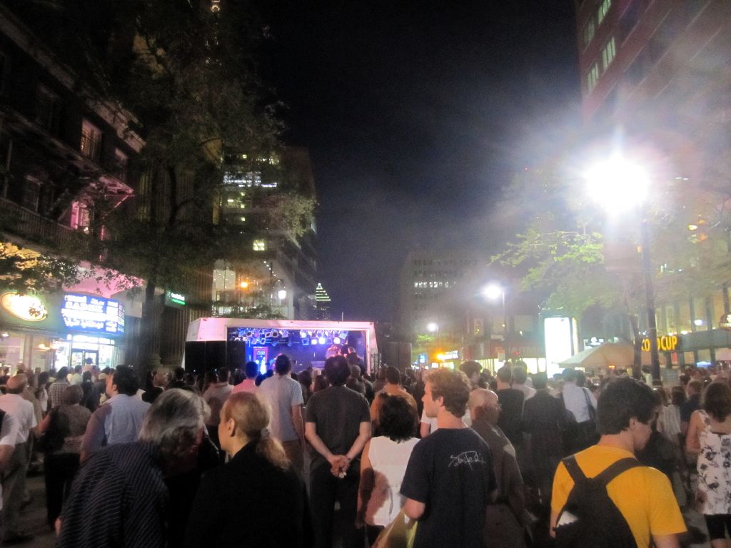
Some street festival/concert in the Concordia Ghetto

The street is always full of people, many more than there are cars. In fact, as a car user, you should really know not to drive on Ste-Catherine, because it is essentially useless as a car artery. Traffic flows really slowly due to too many traffic lights, and is interrupted half way by all sorts of festivals, pedestrianized areas, or road closures because of construction.

If not the pedestrians, some construction will surely block the path, anyway

At this point, hasn’t the street shown its viability has a people-only space? Haven’t drivers given up on this street at this point, anyway? Can’t we finally ban the cars for good, and maybe add a bike lane? Don’t we want every day to be car-free day on Ste-Catherine?

Better Buses I: Frequent Service Does Not a Network Make

Tuesday, September 21st, 2010

This is part I of a series on ideas how to make bus services more attractive

While making a map for Montreal’s frequent bus service, branded the “10 minute network”, it became obvious that just taking a couple of heavily utilized bus lines and upgrading or labeling already existing all-day frequent service doesn’t make a network yet. The STM should now focus on creating creating a new level of service. Before this brand there were two levels of transit within the island of Montreal: A primary, The metro, with high speed, high frequency and good reliability in a network that can be easily understood; and a secondary, a large list of bus lines, with all sorts of different service patterns and some with very low frequency (I am not counting the commuter trains at this point, since they don’t seem to be designed for people on the island of Montreal).

Many users will likely rely on the metro as much as possible and only switch to buses where the metro is not available — or when taking a trip every day. Commuters tend to find the services that is most useful to them, even if it is obscure, infrequent and relies on expert knowledge. The metro on the other hand will get you to many places and the only thing you need to know when you start your journey is the station where you want to get off; no schedules or further geographical knowledge is needed.

The reseau 10 minute max attempts to create a new secondary network, supplementing the metro, which can also be easily understood and which is frequent so that no schedules are needed (we’ll see about the reliability come next winter). It is most useful if it emulates the user experience of the metro as much as possible, while creating a network that makes sense by itself, covering most of the city in tandem with the metro. It should be accessible and appealing to the novice user, who can then reach any part of the city without much preparation etc. This should improve mobility, and thus the ability to rely on public transportation, making it more competitive form of transport.

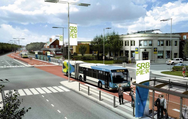
This idea is partly due to Jarret Walker at provide a similar experience as rail, that they are equal in a way. I believe that rail is the better form of transit in many instances, but it is simply not affordable in most places, either to build or operate. Montreal is currently in phase I and doesn’t even know the costs of the 3 km extension of the blue line. It may be completed by 2016 or so – 10 years after last extension. If the province manages to build only 3km every 10 years, the system will never cover the entire city (because it grows faster than that). Even a planned Bus Rapid Transit line along Boulevard Pie-IX is is now estimated to cost 305$M. Although not grade separated like “real BRT”, it will still cost 20$ million per Km.

Planned BRT along Boulevard Pie-IX - at 20$ M per km

So it is not really realistic to ask for the metro to spread all across the city, or even bus rapid transit as planned on Pie-IX. The secondary network of frequent bus lines is all we have in many parts of the city, and we should make the best of it. In the following series, I will discuss a couple of comparatively simple ways to create a better secondary form of transit, mostly by emulating the user experience of rapid transit. These ideas should not only be applicable to Montréal, but also other cities.

Continue on part II.

A Map for Montréal’s frequent service

Thursday, September 2nd, 2010

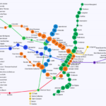
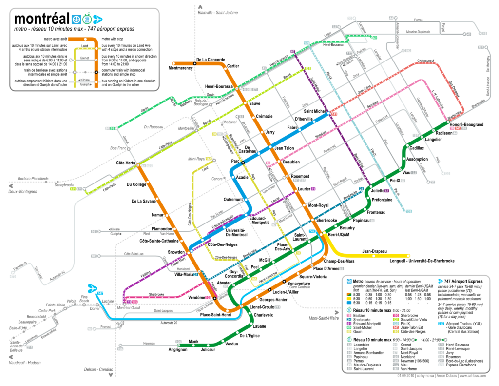
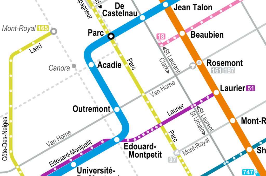
As mentioned in a previous post, I’ve been working on a frequent service map of Montreal’s new réseau 10 minute max (10 minute network). Just a couple of days after the new schedule went on effect on August 30th, I am now publishing this map (under cc-by-sa-nc).

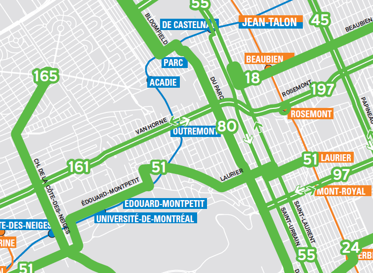
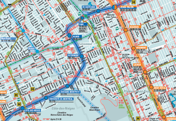
The stm also published a map. But theirs is basically just the full system map with the whole system (except the metro) removed and the frequent lines added in thick lines — it’s still a huge map (because it is geographically accurate), for a relatively simple system. Also, the lines often sit on top of the metro lines, so it’s hard to read.

I wanted to make a map that is similarly abstract as the old metro map, to show the similarity between the frequent service network and the metro system itself. Both should be accessible without needing any schedules, or knowing the area well where one is travelling. I wanted to combine the simplicity of the traditional tube map with the look and feel of the Montreal metro map (and the new stm designs) while adding in the frequent bus lines – and all that in a letter format.

The result is indeed letter sized (with 5mm margins), and designed to fold twice (along the legend boxes), albeit with some pretty small fonts. Nevertheless, it should be possible to carry this map along all journeys much more easily than the whole system map — this independence is sort of the intent of the original London tube map, and also of the new frequent service network.

I added the commuter train stations on the island of Montreal, something that the metro map doesn’t show. Although they don’t run frequently, the connections are good to know and an imprtant aspect of the public transportation network — so they are shown in greyed out, dotted lines. I also added the airport express bus, even though it runs at a lower frequency than 10 minutes, because of it’s success and general importance. The legend shows that it runs less often.

The stm chose a system of 11 lines with 10-minute frequent service running form 6am to 9pm, and a set of 19 lines that run frequent in the downtown direction from 6am to 2pm, and in the opposite between 2pm and 9pm. These lines don’t qualify as all-day frequent service, so they are also shown greyed out, with arrows indicating the morning/downtown direction. I assigned colors to the all-day frequent lines as if they were metro lines, based on the sort of pastell color theme of the stm.

A feature that is not even in the full system map is the indication of all stops along the bus lines. While I didn’t actually name any, it still provides useful information – it gives an indication of how long it takes to traverse a certain route (the more stops the longer it takes), and it gives an idea of how many stops it takes to go from one intersection to another. The one should help people to be more independent of schedules by being able go estimate how long a trip will take, and the other helps people to navigate the city riding the bus without knowing a certain area. Both are intended to lower the barrier of entry for new users (or users new to an area, or tourists) to be able to use the bus system. A focus on usability in public transport systems (especially buses) is sometimes lacking, but attempting to create user experience similar to a metro system should help attracting riders.

A 600 dpi version can be found here. And a pdf. Or the svg. (update: I correct errors only on these files.)

This project was partly inspired by Jarret Walkers treatment of frequent service ideas over at human transit. Most of the above links direct to his discussions of the topic. I have also taken a closer look at the bus network.

Check out the most recent update.